Soution: The advent of automated drone operations marks a significant leap forward in the application of unmanned aerial vehicles (UAVs). These sophisticated machines are now capable of executing flights based on pre-programmed schedules and geographical waypoints, with minimal human intervention. The integration of advanced sensors and algorithms allows drones to autonomously return to their origin […]
Solution: Drones can create accurate 3D maps of affected areas, improving search and rescue capabilities. Equipped with infrared sensors, drones can locate objects and people trapped in the search area. This allows for quick and efficient surveying and identification of hard-to-reach areas. Wildfire Detection and Monitoring: Drones equipped with thermal sensors can detect fire zones […]
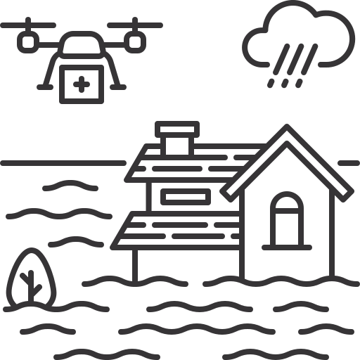
Solution: Drones are increasingly becoming vital tools in maritime applications, offering a high level of efficiency in monitoring and data collection over vast ocean areas. Equipped with advanced sensors and imaging technologies, drones can collect detailed data to compare area changes over time, providing valuable insights into coastal erosion, habitat loss, or the effects of […]
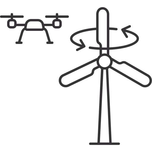
Solution: Drones equipped with high-resolution cameras and specialized sensors can navigate the complex interior spaces of wind turbine columns, recording any damage with precision. This method not only enhances the accuracy of inspections but also increases safety by reducing the need for manual inspections in potentially hazardous environments. Furthermore, the reconstruction of the internal structure […]
Solution: For onshore wind turbines, Drone is used. For offshore turbines, with higher performance, wind resistance, and longer flight time is employed. On land, Drones takes off from the ground and flies to the designated turbine for inspection. Offshore, along with the pilot team, travels by boat to the turbine location. The aircraft then takes […]
Solution: Drone surveys are revolutionizing the maintenance and inspection of onshore wind turbine columns, offering a safer and more efficient alternative to traditional methods. Drones can navigate the complex environments of wind farms, providing high-resolution images and precise data without the need for human inspectors to undertake risky climbs. This not only enhances safety by […]
Solution: Sowing Seeds, Fertilizing… The distance and density of the seeds are uniform with the precise mapping capability of the drone combined with a specialized seeding system that can sow seeds and fertilize to the desired location. The unique roller design (rotating shaft, sowing) offers various options to ensure that the seeds and fertilizer do […]
Solution: The use of drones for spraying plant protection chemicals represents a significant advancement in agricultural technology. Equipped with centrifugal technology, these drones can break down pesticide particles into a fine mist, which enhances the adhesion and penetration of the chemicals on crops and flowers. This method not only ensures a more uniform distribution of […]
Solution: Drones have revolutionized the way we capture data, offering a high degree of accuracy in terrain and elevation measurements which is crucial for monitoring changes over time. Drones are an invaluable tool in various fields such as agriculture, construction, and environmental monitoring. The accuracy of drone surveys depends on several factors, including the quality […]
Solution: The integration of AI with drone technology is revolutionizing the field of precision agriculture, particularly in the monitoring and analysis of crop health. AI-powered drones are equipped with advanced sensors and imaging capabilities that can detect early signs of disease, nutrient deficiencies, and water stress in crops. By analysing the data collected, AI algorithms […]
Solution: Drones have revolutionized the field of wildlife conservation, offering a bird’s-eye view to monitor remote and inaccessible landscapes. This aerial surveillance technology is being used worldwide to assist in landscape monitoring, wildlife population estimations, countering poaching, and addressing human-wildlife conflicts. For instance, drones equipped with thermal cameras can accurately count populations of elusive species, […]
Solution: Drones have revolutionized the way fire risks are evaluated, and response strategies are determined. Equipped with advanced sensors and cameras, drones can quickly survey an area, providing real-time data on the spread of a fire, the topography of the land, and potential escape routes for those in danger. This aerial perspective is invaluable for […]